Credits
Every photograph on this site
Licences were checked on each source page on 18 November 2026. Public-domain NASA and allied stills are used throughout. One still, where used, is CC BY 2.0 and is credited on this page.
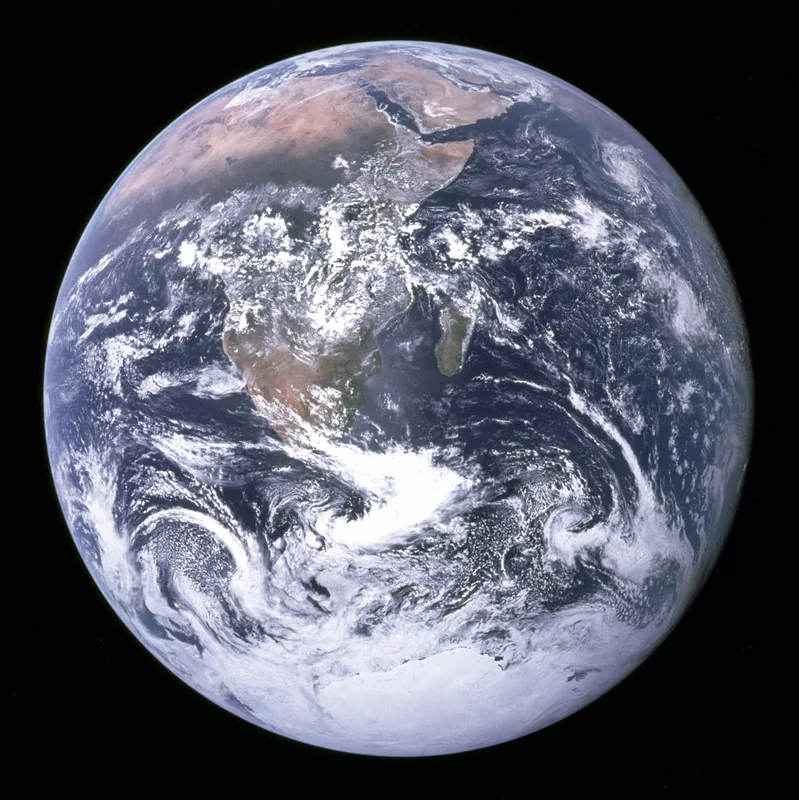
The Blue Marble, photographed on 7 December 1972 by the crew of Apollo 17, en route to the Moon, from about 29,400 kilometres (18,300 miles). It shows Africa, Antarctica and the Arabian Peninsula. The file is careful about the shutter: it was taken by either Harrison Schmitt or Ron Evans. Public domain. Photo: NASA / Apollo 17 crew (Harrison Schmitt or Ron Evans) · Public domain · NASA / Wikimedia Commons 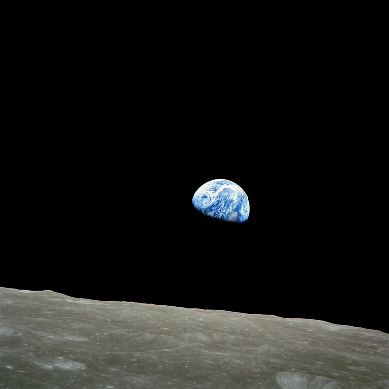
Earthrise, photographed by Apollo 8 crewmember Bill Anders on 24 December 1968, at 16:40 UTC, while in orbit around the Moon. The file notes that this is the Earth rising for the third time above the lunar horizon, and that the horizon is about 780 kilometres from the spacecraft. Public domain. Photo: NASA / Bill Anders · Public domain · NASA / Bill Anders / Wikimedia Commons 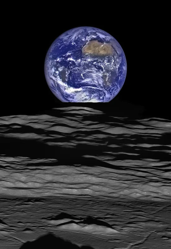
The Earth straddling the limb of the Moon, as seen from Lunar Reconnaissance Orbiter above Compton crater, in a still dated 12 October 2015. The official caption points out the shadow of the crater’s central peaks in the foreground. A later earthrise, from a robotic orbiter, kept here beside Anders’s photograph and not instead of it. Public domain. Photo: NASA / Goddard Space Flight Center / Arizona State University · Public domain · NASA/GSFC/ASU / Wikimedia Commons 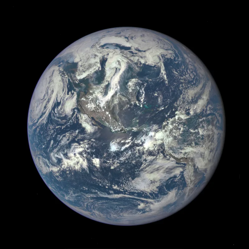
Earth as seen on 6 July 2015 from a distance of one million miles, by DSCOVR’s EPIC scientific camera. A full, sunlit disk, from far enough out that the whole dayside fits in one frame. Public domain. Photo: NASA / DSCOVR EPIC · Public domain · NASA / Wikimedia Commons 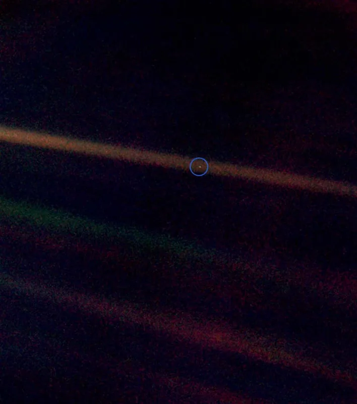
The Pale Blue Dot, photographed by Voyager 1 on 14 February 1990. The official caption says Earth is the relatively bright speck of light about halfway across the uppermost sunbeam. This is a portrait of a planet, and it is almost nothing to look at until someone tells you which speck is home. Public domain. Photo: NASA / JPL / Voyager 1 · Public domain · NASA/JPL / Wikimedia Commons 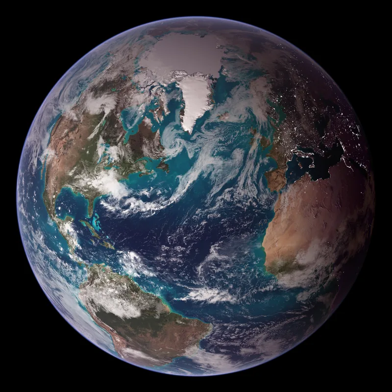
A western-hemisphere Blue Marble, released on 9 October 2007, from NASA images by Reto Stöckli based on Terra MODIS data. The official release speaks of a day’s clouds, the living ocean, and a view that is a fusion of science and art. A composite, not a single shutter click — and labelled as such. Public domain. Photo: NASA / Goddard Space Flight Center / Reto Stöckli, based on data from NASA and NOAA, Terra MODIS · Public domain · NASA/GSFC / Reto Stöckli / Wikimedia Commons 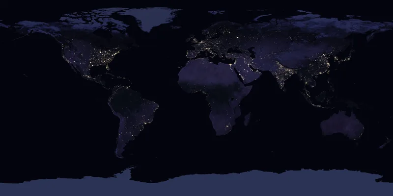
Earth’s night lights as observed in 2016, a NASA Earth Observatory Black Marble composite. The official caption says the compositing technique selected the best cloud-free nights in each month over each land mass. City lights as a human signature, not a single night’s photograph. Public domain. Photo: NASA Earth Observatory / Joshua Stevens, using Suomi NPP VIIRS data from Miguel Román, NASA GSFC · Public domain · NASA Earth Observatory / Wikimedia Commons 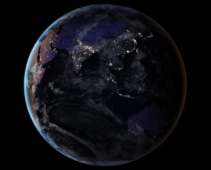
City lights of Asia and the Middle East, drawn from the 2016 global Black Marble composite and described by NASA Earth Observatory. A closer look at the same official night map, not a second, separate year. Public domain. Photo: NASA Earth Observatory · Public domain · NASA Earth Observatory / Wikimedia Commons 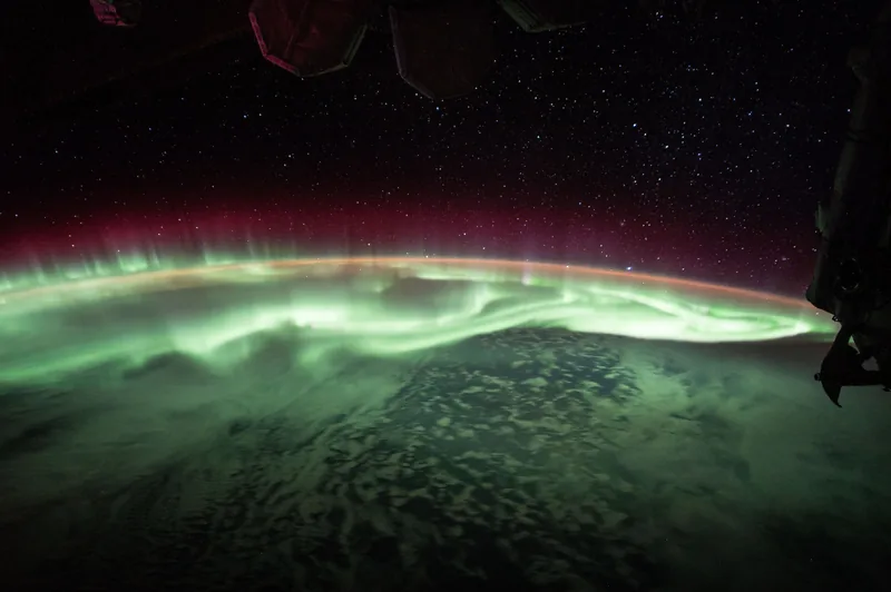
Aurora australis above Antarctica, photographed from the International Space Station by NASA astronaut Jack Fischer on 25 June 2017. NASA Science’s facts page explains aurorae as solar-wind particles trapped in Earth’s magnetic field, colliding with air molecules above the magnetic poles. Public domain. Photo: NASA / Jack Fischer · Public domain · NASA / Jack Fischer / Wikimedia Commons 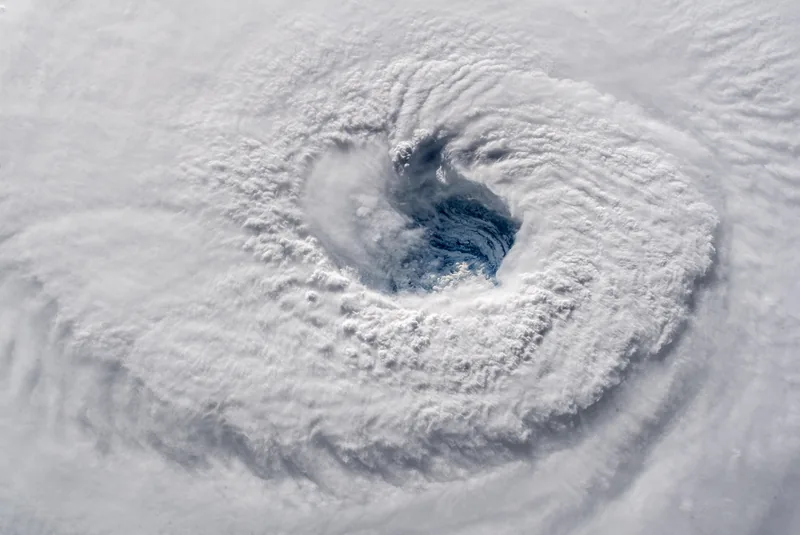
Hurricane Florence, photographed from the International Space Station by astronaut Alexander Gerst on 12 September 2018. The photographer’s own words, kept on the file: “Ever stared down the gaping eye of a category 4 hurricane? It’s chilling, even from space.” Public domain. Photo: Alexander Gerst · Public domain · Alexander Gerst / Wikimedia Commons 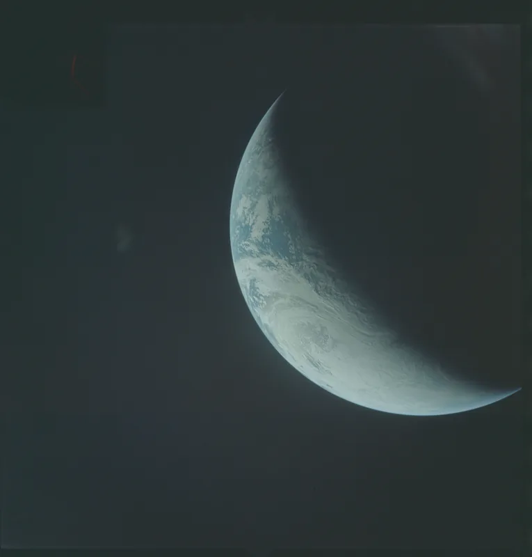
Photographed from the unmanned Apollo 4 mission (Spacecraft 017/Saturn 501) on 9 November 1967, at 17:39. The original database describes coastal Brazil, the Atlantic Ocean, West Africa, the Sahara and Antarctica, looking west. An early colour look at a curved Earth, before anyone had stood on the Moon to see it rise. Public domain. Photo: NASA / Apollo 4 (unmanned) · Public domain · NASA / NARA / Wikimedia Commons
Enjoyed two official distances for an AU, a 71-percent ocean, and a pale blue dot in a sunbeam?
No pop-ups. No intrusive advertising. Just interesting stuff. A little support helps the next planets.im site get built.